Bushfire Simulation vs Reality: The Kemps Lane Fire
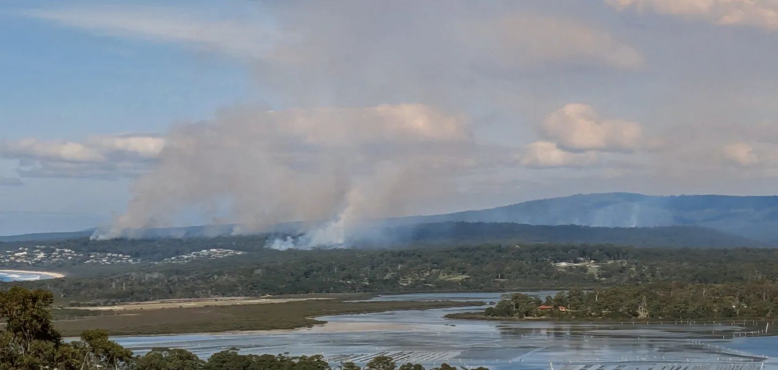
I ran a simulation out of curiosity on a Friday afternoon. Two hours later my pager went off and I was standing in it.

Matthew Robards
As a co-founder of FiSci and a volunteer firefighter with the NSW Rural Fire Service, fire is a central focus of both my professional and volunteer life. Those activities usually manifest as either software development or on-ground response. An event last Friday provided a rare and direct convergence of the two.
Early warning and initial simulation
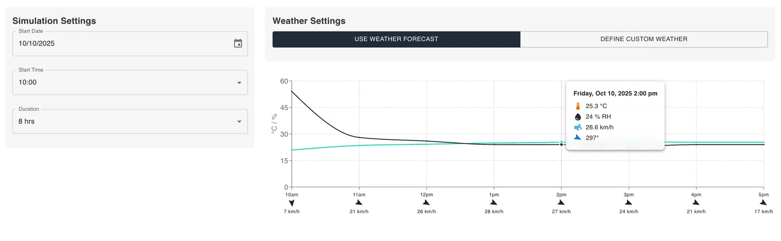
While concluding my professional duties for the week, I received an alert via the Hazards Near Me app about a grassfire that had ignited just west of Candelo. An understanding of the local fuel types — specifically the highly volatile African lovegrass prevalent in the region — combined with warm, dry and windy conditions suggested a high potential for rapid fire development.
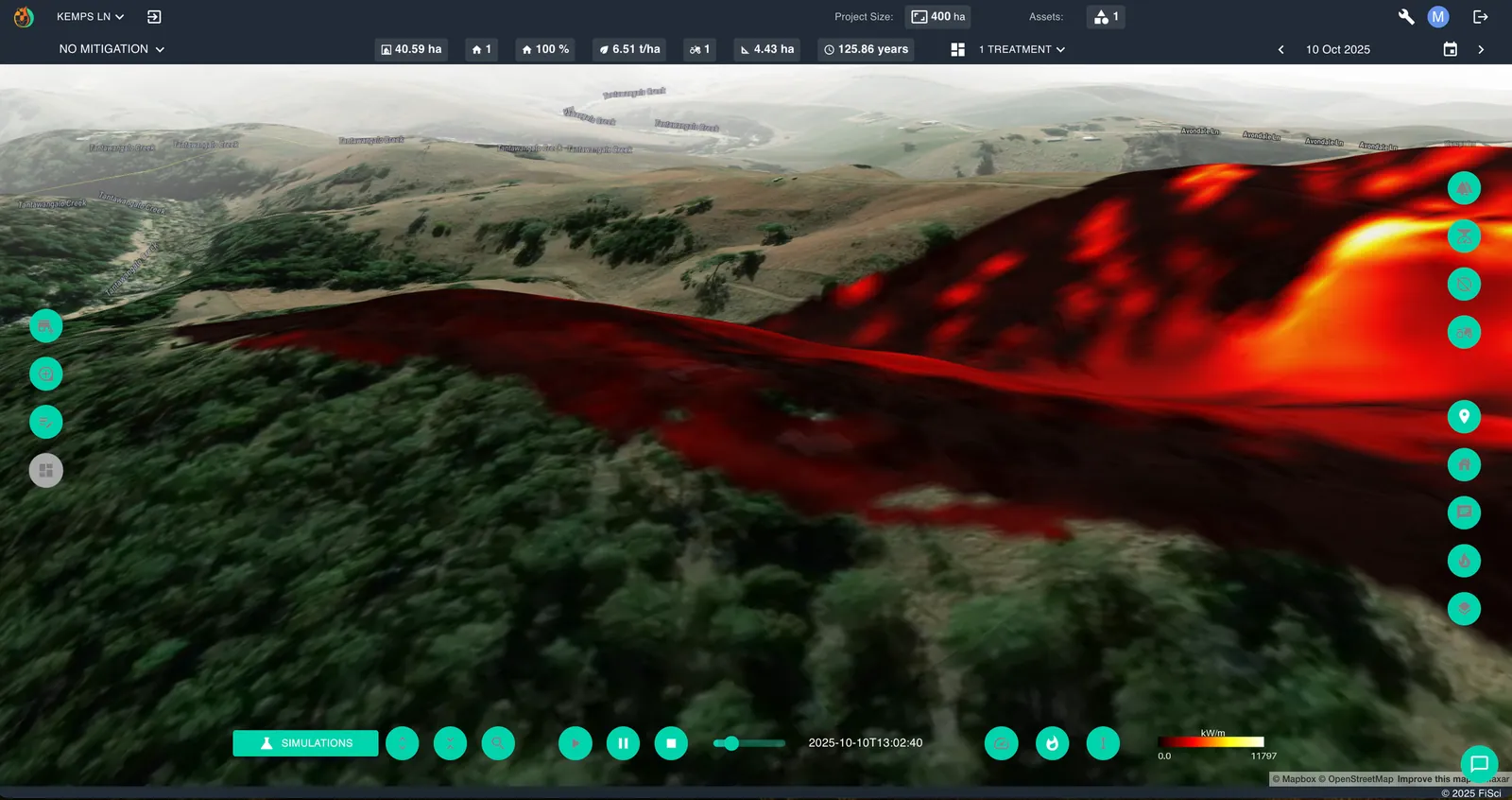
Out of curiosity, I started a simulation in FiSci Mitigate, estimating the ignition point and using the integrated weather forecast data for the day.
The results gave a clear projection: rapid propagation in a south-westerly direction, with the fire’s advance likely to be halted at Kemps Lane.
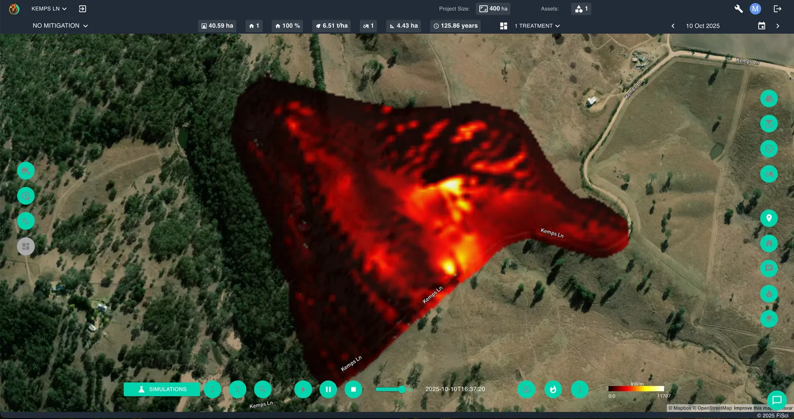
Operational timeline
This simulation represented a probable reality for the crews already engaged in suppression. Shortly after midday it became my reality too: my pager went off, mobilising our crew for deployment. By that time the simulation showed the fire had already grown significantly.
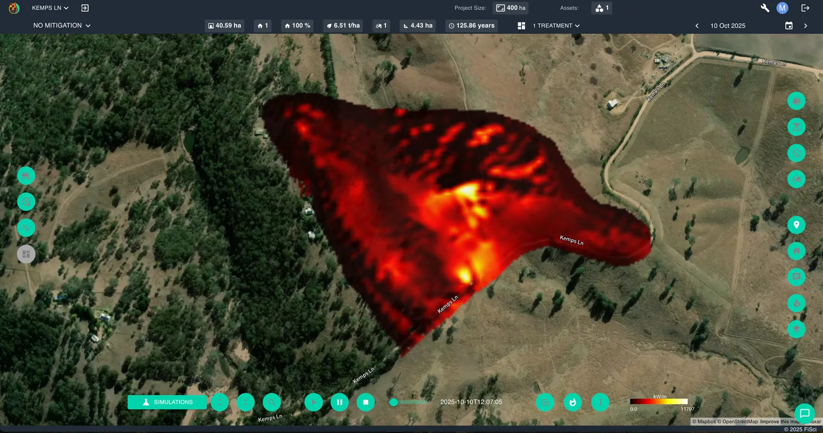
On arrival at 13:00, conditions on the ground closely corroborated the simulation’s output. The fire was making significant runs along the hillside, posing an immediate threat to nearby properties. Our crew’s first tasking was property defence and slowing the fire’s lateral spread. This was the most intense period of fire activity I experienced that afternoon.
By 15:00, suppression had slowed the forward spread on the hillside, though the fire continued to back down the slope at a lower intensity.
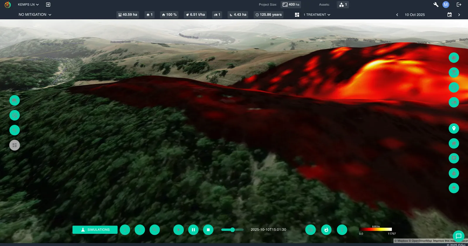
By 18:00 the fire had effectively pulled up against containment lines, suppression and favourable terrain, with the simulation closely matching the established perimeter. At approximately 19:00 it was contained.
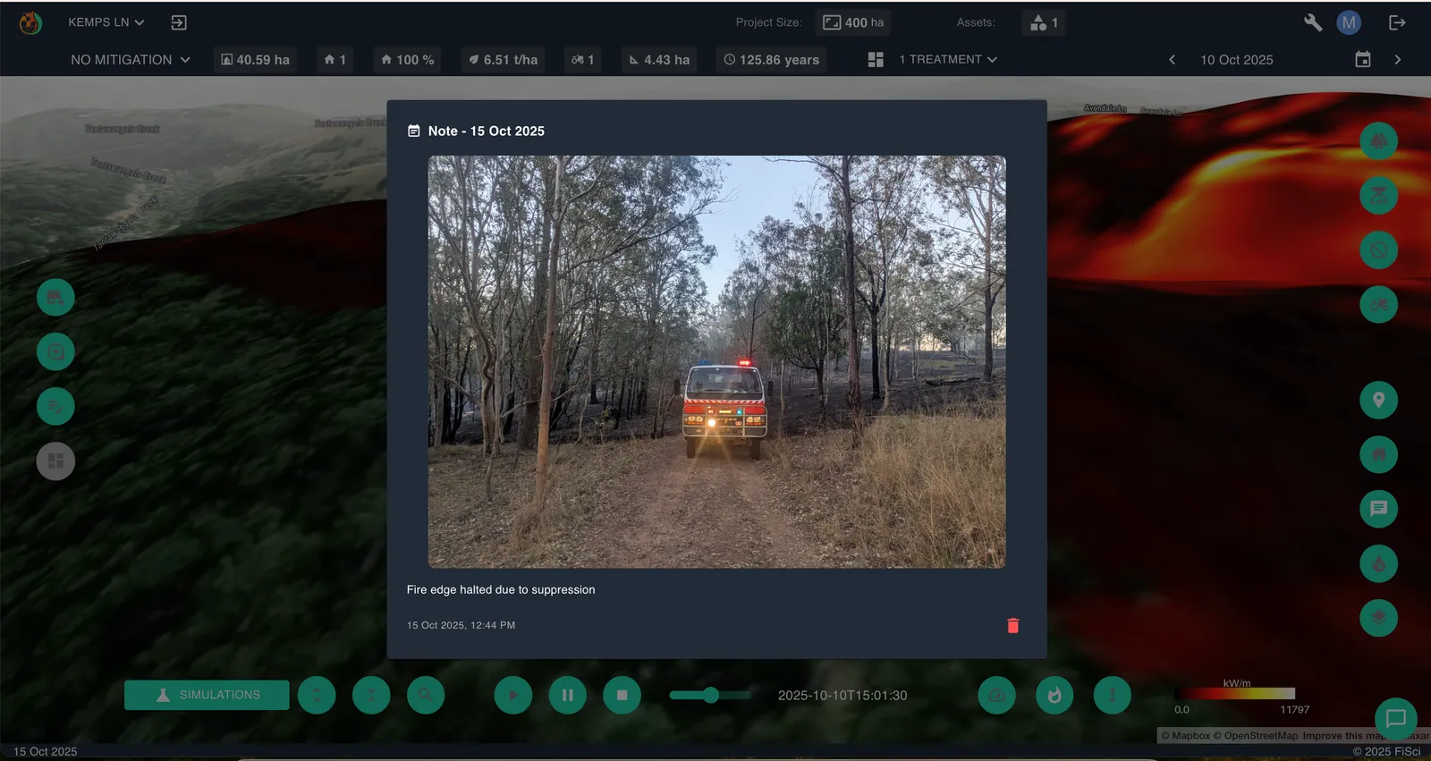
Post-incident analysis and validation
Being physically present on the fireground, with prior knowledge of the simulated spread across that exact terrain, was a notable experience. The subsequent eight-hour operational period highlighted the skill and dedication of everyone involved. Crews encountered periods of intense and challenging fire behaviour while collaborating with multiple brigades to achieve containment.
A post-incident review of the official fire map in the following days revealed a remarkable correlation with the initial simulation.
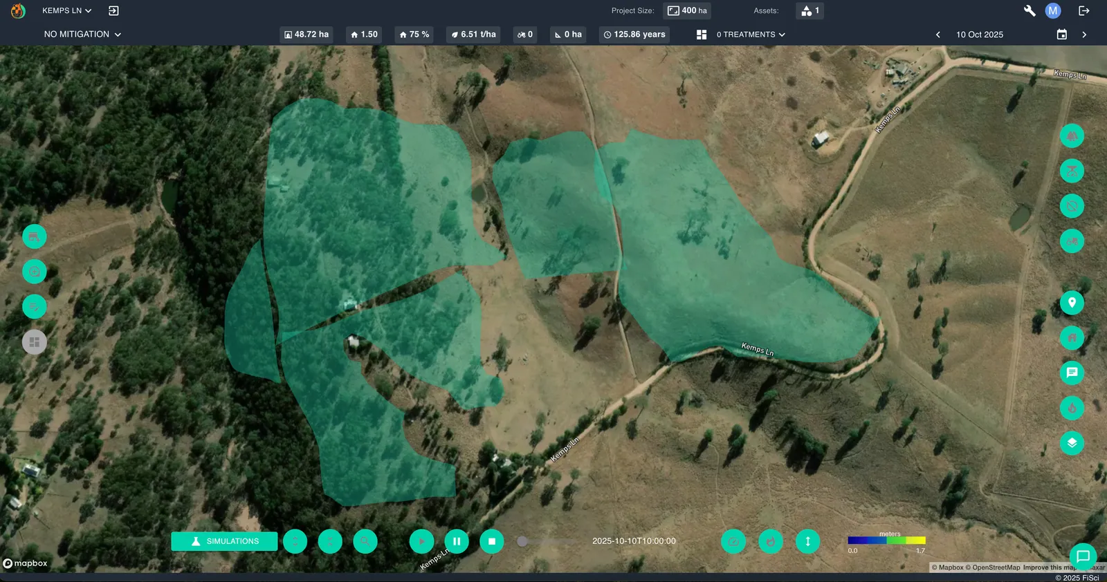
While the correlation is strong, some differences are apparent. The unburnt patch in the middle of the final footprint, for instance, is likely the result of successful suppression that was not modelled in this simulation.
The role of predictive technology
It is important to emphasise that technologies such as Mitigate are not intended to replace the invaluable experience of on-ground firefighting personnel. They are decision support. Their purpose is to inform strategic decisions and anticipate fire progression, offering predictive insight that assists with planning and resource allocation — particularly during the critical initial stages of an incident.
Incidents such as last Friday’s are a primary motivator for the work we do at FiSci. The objective is to furnish an additional layer of actionable intelligence to support the vital work performed by emergency services. Ultimate credit for the successful containment of the Kemps Lane fire belongs to the many firefighters from across the Bega Valley who responded.
Stay safe,
Matt