Fire Scar Mapping Accuracy on the Stuart Highway
Ground-truthing a deep learning fire scar model with Google Street View, and finding it correct down to a single clump of trees.

Kevin Bonner
Bushfires shape landscapes across Australia, and managing their impact — especially through proactive mitigation burns — is a critical task. But how do we accurately assess the extent and effectiveness of those burns, particularly in remote areas? At FiSci we’re using deep learning to answer that, and we’ve found an unexpectedly powerful ally in a tool many of us use every day: Google Street View.
The vastness of the Territory
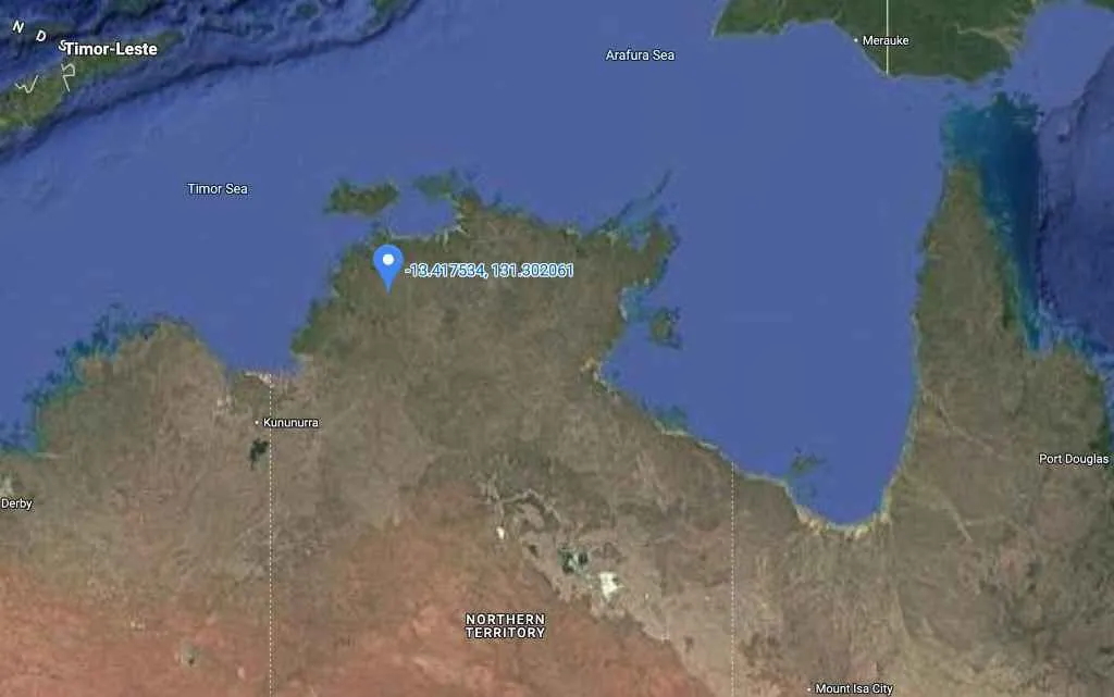
The Australian outback is a landscape of immense scale. Our focus here is a stretch of the Stuart Highway in the Northern Territory.
To understand why mitigation burns matter, take a virtual trip back in time. A Street View image from December 2014 along the same highway shows dense grass fuel loads — conditions that highlight the potential for intense, widespread fire if left unmanaged.
A new eye in the sky
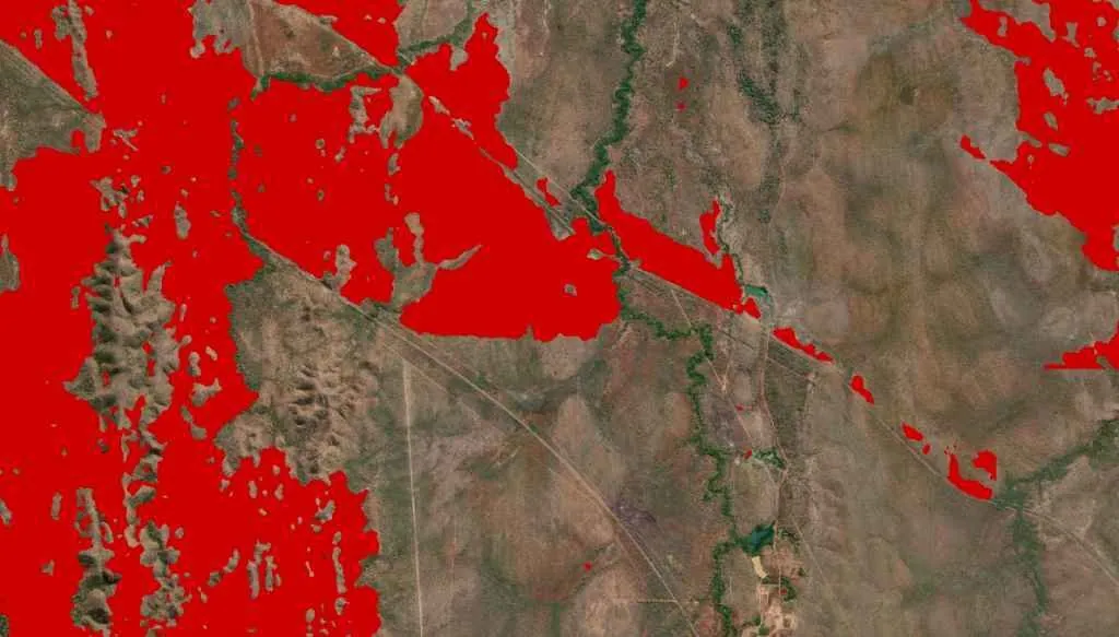
Fast forward to a recent early dry season, and a strategic mitigation burn has been conducted. This is where FiSci’s deep learning algorithm comes in. Trained to analyse satellite imagery with considerable acuity, it detects and maps fire scars at a new level of detail.
Ground-truthing with a digital drive-by
Satellite data is powerful, but how can we be sure of its accuracy on the ground, especially with intricate detail? Traditionally that means costly, time-consuming field visits.
But we had an idea: use Google Street View’s archives to visually correlate the algorithm’s findings. It’s like having thousands of geo-located, time-stamped photos at our fingertips.
Proof in pixels: the highway as a firebreak
Our algorithm indicated the fire scar running right up to the northern edge of the Stuart Highway, suggesting the road acted as an effective firebreak.
A quick virtual drive to the exact coordinates in Street View, captured in September 2023 post-burn, provided striking confirmation. To the right — north of the road — clearly burnt. To the left, south, unburnt.
Down to ten metres
The story gets more compelling when we zoom in. The algorithm operates at ten-metre resolution, which means it can identify relatively small features in the landscape.
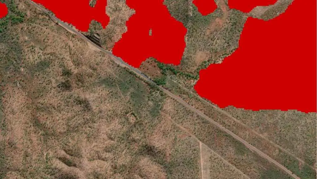
Notice a distinct clump of trees at the edge of the detected fire scar. The algorithm shows the fire stopping precisely at those trees. Could that level of detail be real? Street View again provided the answer: looking toward that exact clump of trees in September 2023, the fire did indeed halt right where the algorithm indicated.
Beyond detection
This combination doesn’t just tell us where a fire has burned; it helps us understand the nuances of its behaviour. We can see how landscape features like roads, and even small stands of vegetation, influence fire spread. That’s invaluable feedback for land managers, helping refine mitigation strategies and improve ecological understanding.
The view from space is powerful. Combined with a perspective from the ground — even a virtual one — it becomes considerably more useful.