
Mount Nelson: protecting a college on a steep urban fringe
A planned burn above Hobart, modelled before it happened — and the follow-up treatment the model says should come next.
- Project area
- Mount Nelson, greater Hobart
- Terrain
- Steep, undulating, heavily forested
- Vegetation
- Eucalyptus variations
- Fuel load
- In excess of 20 t/ha in high-risk areas
- Prior treatment
- Hazard reduction south and west, 2016–2021
- Simulation window
- 8 hours per ignition, extreme conditions
- Average fire size
- −40%
- Untreated average fire
- 130 ha
- Peak fuel load
- 20+ t/ha
Across the project area under the same extreme weather, after treatment.
Mean uncontrolled fire size over an 8-hour period before treatment.
Uninterrupted heavy fuel bordering the urban edge.
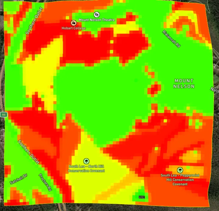
The Mount Nelson area of Tasmania carries a considerable bushfire risk: steep, hilly terrain and high, uninterrupted fuel loads running directly up against an urban edge. Inside the project area sit high-value community assets — Hobart College among them — and the surrounding Mount Nelson residential community.
A prescribed burn was scheduled for 2025 in an area FiSci Mitigate estimates carries very high fuel loads, its boundaries defined by a trail to the north and previous fire boundaries to the west and south. We took that planned burn and modelled it before it happened.
What the landscape looked like going in
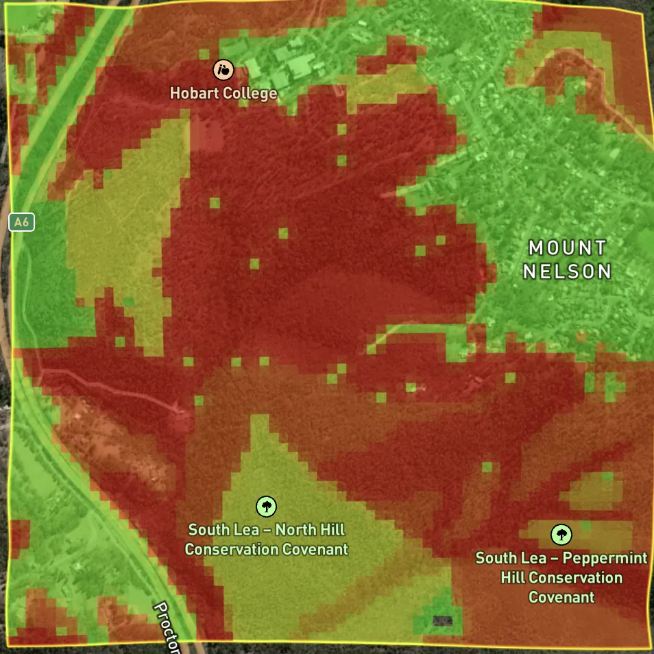
The initial analysis confirmed the exposure:
- The main vegetation communities are Eucalyptus variations, with fuel loads exceeding 20 t/ha in high-risk areas.
- Under extreme weather, the average uncontrolled fire across the project area runs to roughly 130 hectares in eight hours.
- The uninterrupted fuel load significantly increases the capacity for a large, uncontrollable fire.
Historical hazard reduction exists to the south and west, and near the Mount Nelson Theatre, but those burns were carried out between 2016 and 2021 — long enough ago that the fuel has substantially recovered.
The burn, before and after
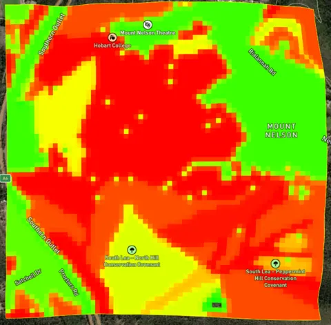
Following the treatment, simulations under the same extreme weather estimate a 40 per cent reduction in average fire size across the project area — a material increase in protection for property and urban areas from fires approaching from the north-west and the south-east.
Scenario one — north-north-westerly
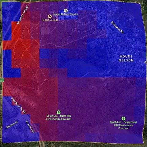
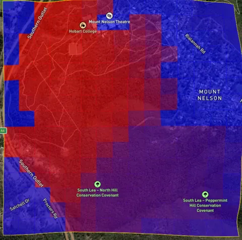
Post-treatment, the reduced fuel load substantially lowers the risk to Hobart College and the community to the east.
Scenario two — south-easterly
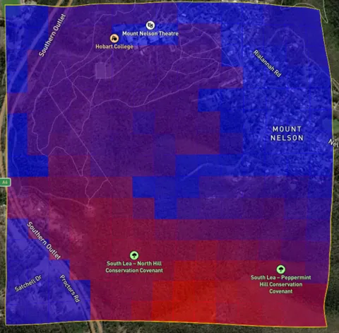
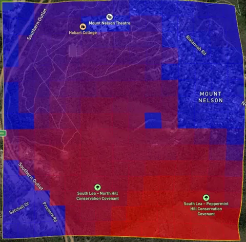
A south-easterly, common in summer, poses less risk to Hobart College and the community to the east once the fuel load to the south has been lowered.
Inspecting a single asset
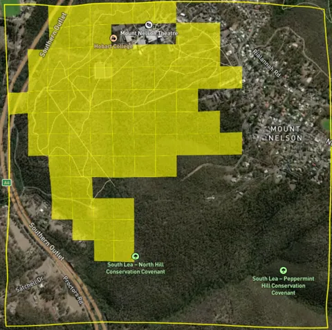
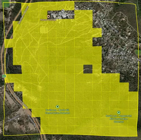
After treatment, the same analysis shows the risk significantly reduced — fires are smaller, they spread more slowly, and they leave a much larger and safer window for reaction.
What we would do next
Based on the post-treatment projections, FiSci recommends an additional treatment to the west in 2026, establishing a low-fuel-load barrier between the heavy fuels to the south and the college.
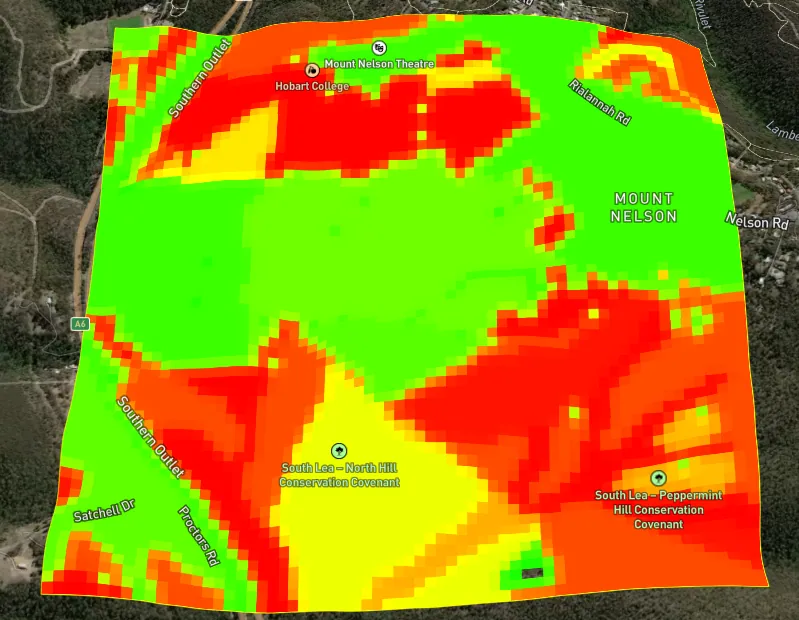
The outcome the strategy is built around is simple to state: protect Hobart College from a fire starting in the south of the project area. The model lets us say how much each block of work contributes to that, before anyone lights a match.