
The Meatworks escape: benchmarking a prediction against a burn that got away
A 23-hectare hazard reduction became a 147-hectare bushfire. We re-ran it, then built the burn strategy that should have been used.
- Incident
- Hazard reduction escape, Meatworks Avenue
- Date
- 21 September 2024
- Planned burn
- 23 ha, aerial incendiary on the north-western boundary
- Actual burn
- ≈147 ha
- Areas threatened
- Cromer Heights, Beacon Hill
- Fuel load
- 8 t/ha in the burn area, up to 20 t/ha beyond
- Relative humidity
- Down to 21%
- Post-burn risk
- 11% → 2%
- Actual fire size
- 147 ha
- Wind at escape
- 26 km/h
Achievable with two prescribed burns in the eastern half of the bushland.
Against a 23-hectare planned hazard reduction.
Embers carried outside containment lines.
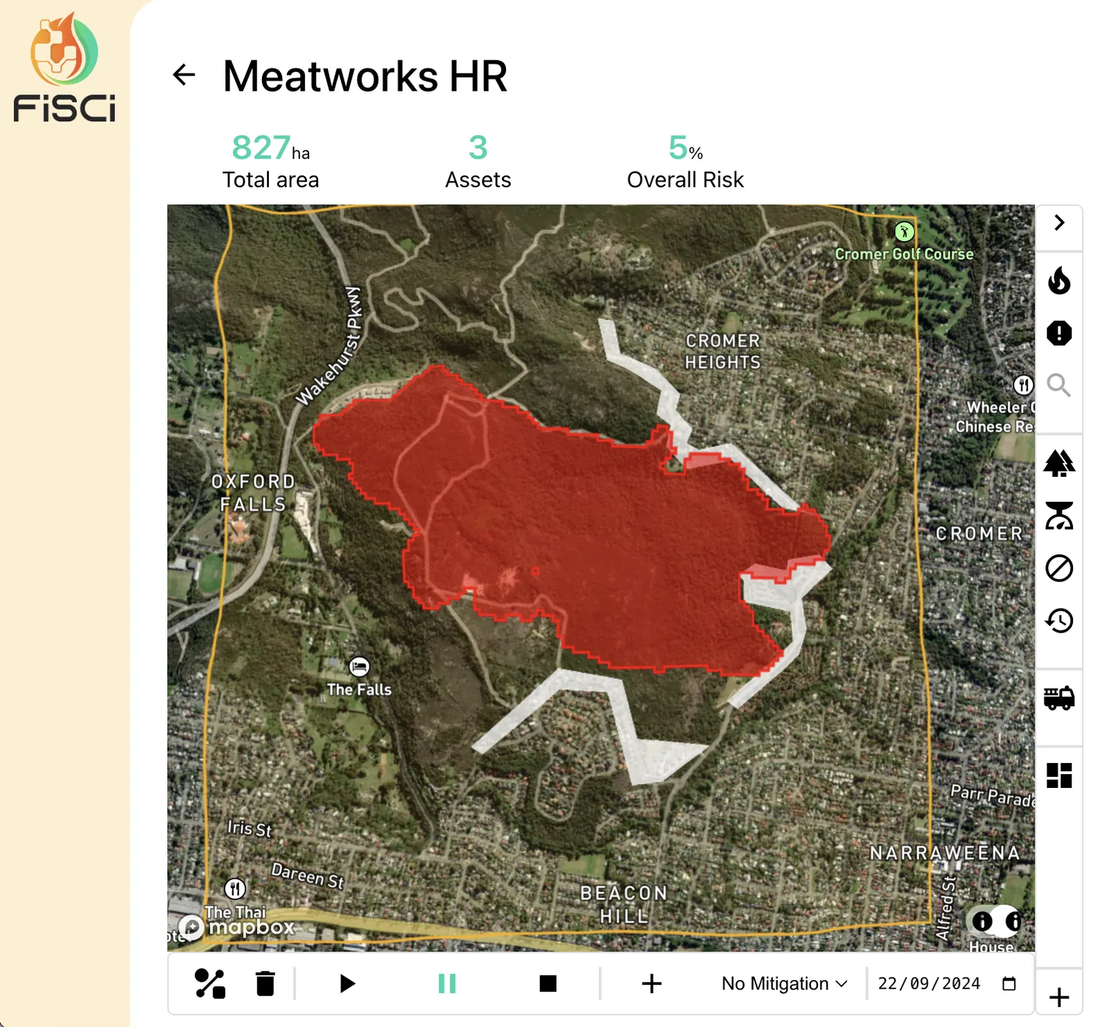
A hazard reduction burn at Meatworks Avenue in Oxford Falls on 21 September 2024 escaped containment and became an out-of-control bushfire, threatening homes in Cromer Heights and Beacon Hill.
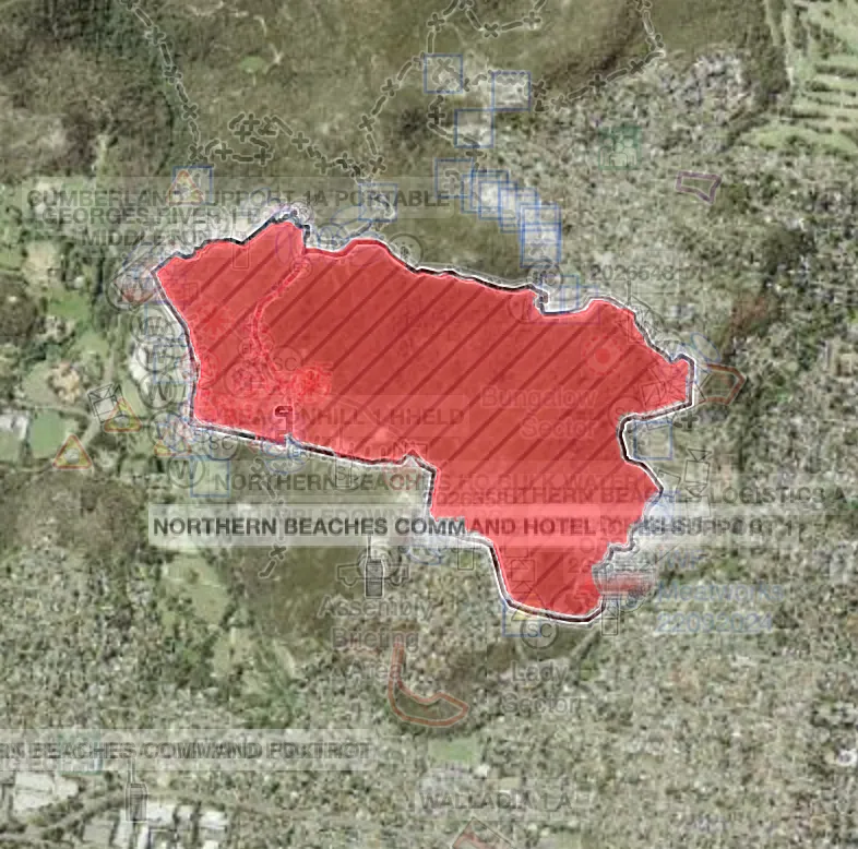
Increased wind speeds and spot fires escalated the situation to the point where residents in Cromer Heights were advised it was too late to leave and to shelter in place. Firefighters brought the blaze — roughly 147 hectares against a 23-hectare plan — back to an advice level later the same day as conditions eased.
We reviewed the incident internally to stretch the platform in two directions: could Mitigate have predicted it, and what would the optimal burn have looked like?
Conditions on the day
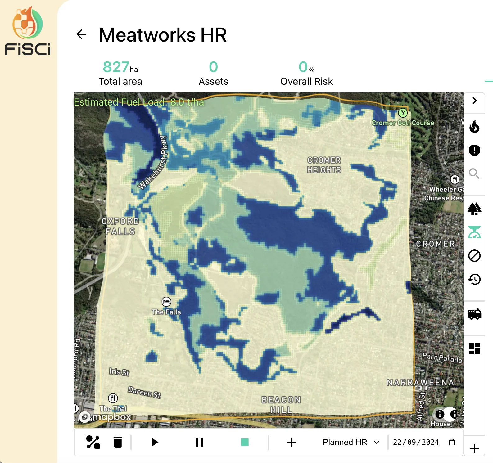
The descriptive layers tell most of the story before any fire is modelled:
- Steep and hilly terrain, moderate temperature and wind, relative humidity falling to 21%.
- The only fire history in the area was a small patch to the north, burnt in 2006.
- Fuel loads of 8 t/ha in the burn area, up to 20 t/ha beyond it.
The risk factors compound. Ignition at the base of a hill, winds blowing uphill, low relative humidity — and, if containment failed, very little distance to travel before the fire reached the heavier fuels that would drive the rate of spread sharply upward.
Benchmarking the prediction
What the burn should have been
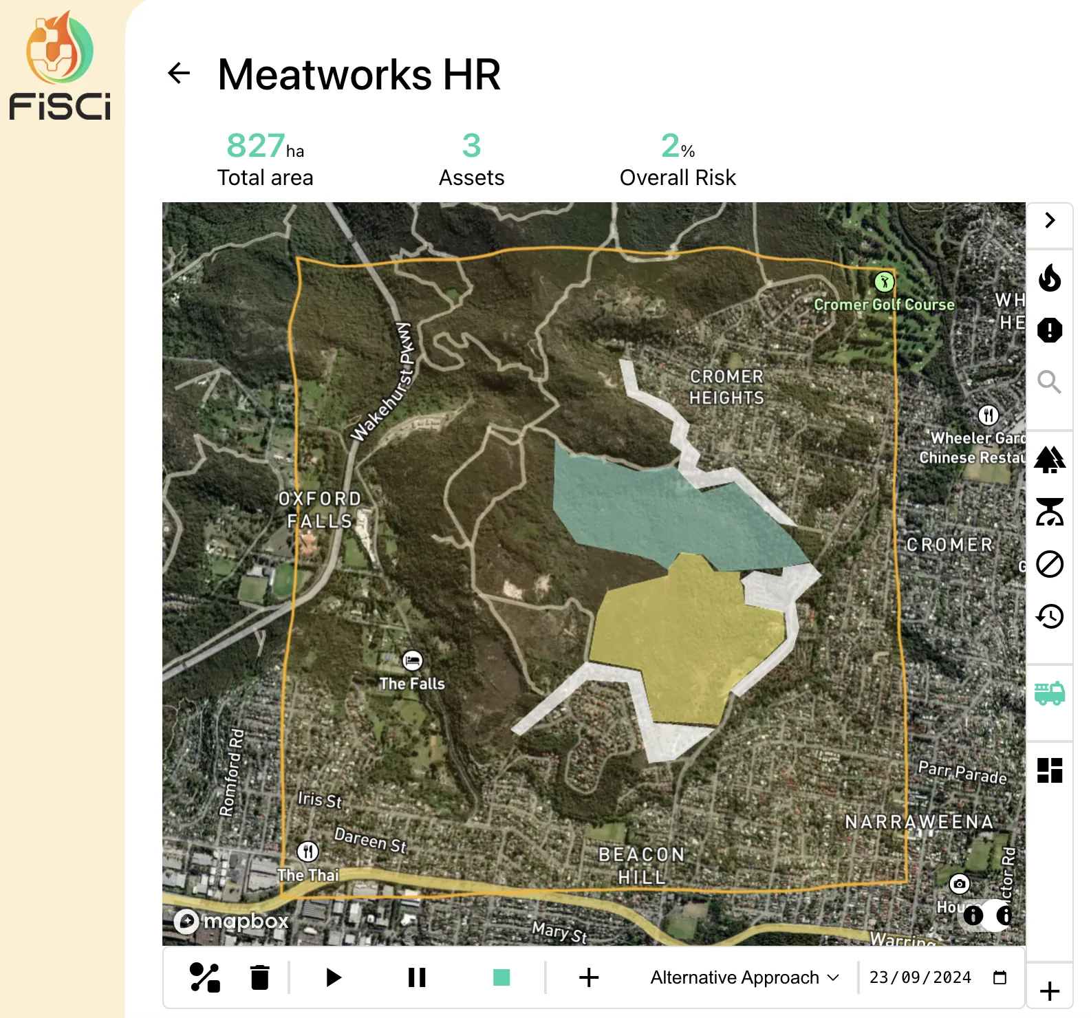
Using Mitigate we built the optimal treatment strategy for the conditions as they stood. Two prescribed burns in the eastern half of the bushland bring overall post-burn risk from 11 per cent down to 2 per cent.
The secondary benefits matter as much as the headline figure:
- The burns sit on slopes with an eastern aspect, so hot dry westerlies push fire in a downhill direction.
- Fire moves more slowly.
- The chance of escape is lower.
- The areas carrying the highest fuel load are the ones treated.
None of this is a criticism of the crews who ran the original burn under the conditions they had. It is an argument for being able to ask the question — what does this burn do if it gets away, and is there a better block? — before the day arrives.
Note — An internal FiSci exercise using publicly reported incident information. Not a paid or affiliated engagement.